
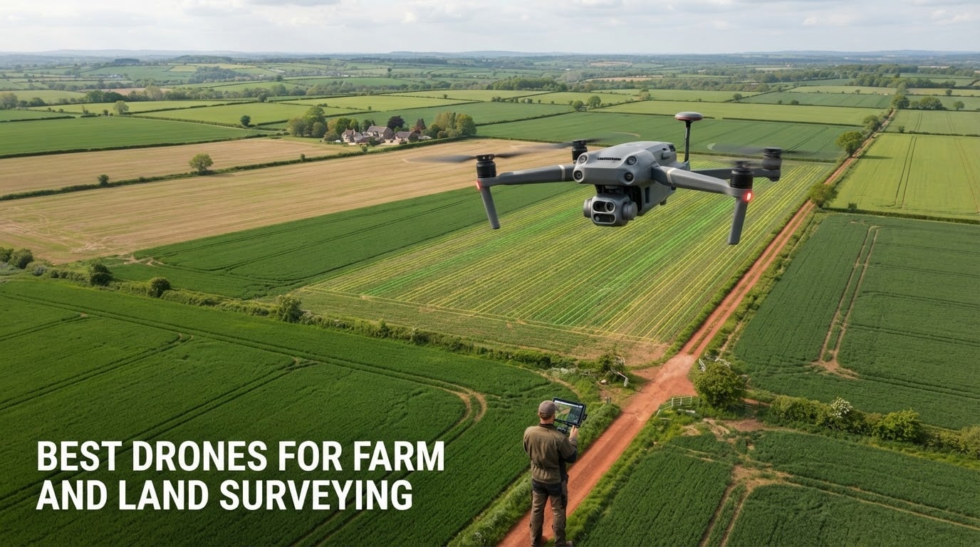
A farm and land surveying drone is one thing: an aircraft built to fly a repeatable survey grid over a field and capture overlapping, geotagged imagery that photogrammetry software turns into georeferenced orthomosaics, elevation models, vegetation index maps and acreage measurements. That definition matters because the word drone now covers everything from a palm-sized toy to a sprayer with a 30 pound tank, and only a narrow slice of that range is actually built for measuring ground.
The practical question behind any search for the best drones for farm and land surveying is not which model is fastest or cheapest. It is which platform matches your acreage, your sensor requirement and your wind exposure, and delivers ground sample distance fine enough for the decision you intend to make with the map. A drainage audit needs centimetre-level positional accuracy and high overlap. A scouting pass over 4,000 acres of row crop needs endurance and a cheap sensor, and nothing else.
This roundup covers seven aircraft that qualified for that narrower surveying and mapping use case. Every one of them flies autonomous waypoint missions, captures geotagged imagery, and outputs into the standard photogrammetry chain. I have grouped them the way operators actually buy them: RTK-capable survey platforms first, then multisensor inspection and thermal aircraft, then the mapping-camera entry points. Pricing is deliberately absent here; use the check buttons, because street prices in this category move weekly.
One clarification before we start. Surveying drones and spraying drones are different products and the two get confused constantly, including in search queries. A sprayer carries a liquid tank and a spray system to apply product to a crop. A surveying aircraft carries cameras and flies measurement patterns. Nothing in this roundup sprays anything, and if your real need is application, none of these seven are the right purchase.
Table of Contents
Top 3 Picks for Best Drones for Farm and Land Surveying (October 2026)

Autel EVO II PRO RTK V3
- 1 cm + 1 ppm RTK accuracy
- 38 min flight time
- 6K 1-inch sensor
- Works without ground control points

Autel EVO II Dual 640T V3
- 640x512 radiometric thermal
- 50 MP RYYB visible sensor
- 38 min flight time
- 360-degree obstacle avoidance

Autel EVO MAX 4N V2
- Four-in-one sensor payload
- Laser rangefinder 5-1200 m
- 42 min flight time
- 20 km SkyLink 3.0 link
The Autel EVO II PRO RTK V3 takes the top slot because it is the only aircraft in this group with a working RTK receiver and a review base deep enough to judge. Reviewers running Pix4D workflows confirm the centimetre-level positioning holds in practice, and the stated 1 cm + 1 ppm horizontal and 1.5 cm + 1 ppm vertical accuracy means field edges land where your boundary work assumes they will.
The EVO II Dual 640T V3 carries the largest owner base here at 53 reviews, and it is the one most farmers end up buying first because thermal alone answers livestock, irrigation and building questions that RGB cannot. The Autel EVO MAX 4N V2 is the most capable sensor package in the lineup, combining starlight night vision, a 50 MP wide camera, thermal and a laser rangefinder in one airframe.
Every Drone in This Roundup at a Glance
| Product | Specifications | Action |
|---|---|---|
| Autel Robotics EVO II PRO RTK V3 |
|
Check Latest Price |
| Autel Robotics EVO II Dual 640T V3 |
|
Check Latest Price |
| Autel Robotics EVO MAX 4N V2 |
|
Check Latest Price |
 DJI Matrice 4TD Quadcopter with RC Plus 2 Enterprise DJI Matrice 4TD Quadcopter with RC Plus 2 Enterprise |
|
Check Latest Price |
 Autel Robotics EVO Lite 640T Enterprise Autel Robotics EVO Lite 640T Enterprise |
|
Check Latest Price |
 2026 Autel Robotics EVO Lite 6K Enterprise Basic Combo 2026 Autel Robotics EVO Lite 6K Enterprise Basic Combo |
|
Check Latest Price |
 Autel Robotics EVO 2 Pro Enterprise V3 Autel Robotics EVO 2 Pro Enterprise V3 |
|
Check Latest Price |
1. Autel Robotics EVO II PRO RTK V3 — Best Survey-Grade Mapping Drone for Most Farms
Autel Robotics EVO II PRO RTK V3 w/Real-time Centimeter-Level Positioning
1 cm + 1 ppm horizontal RTK
38 min flight time
1-inch 6K HDR camera
Supports base station NTRIP and PPK
Pros
- Centimeter-level RTK accuracy confirmed in Pix4D workflows
- Rock-solid stability and return-to-home in 22 mph wind
- Strong 15 km video link with good 6K low-light performance
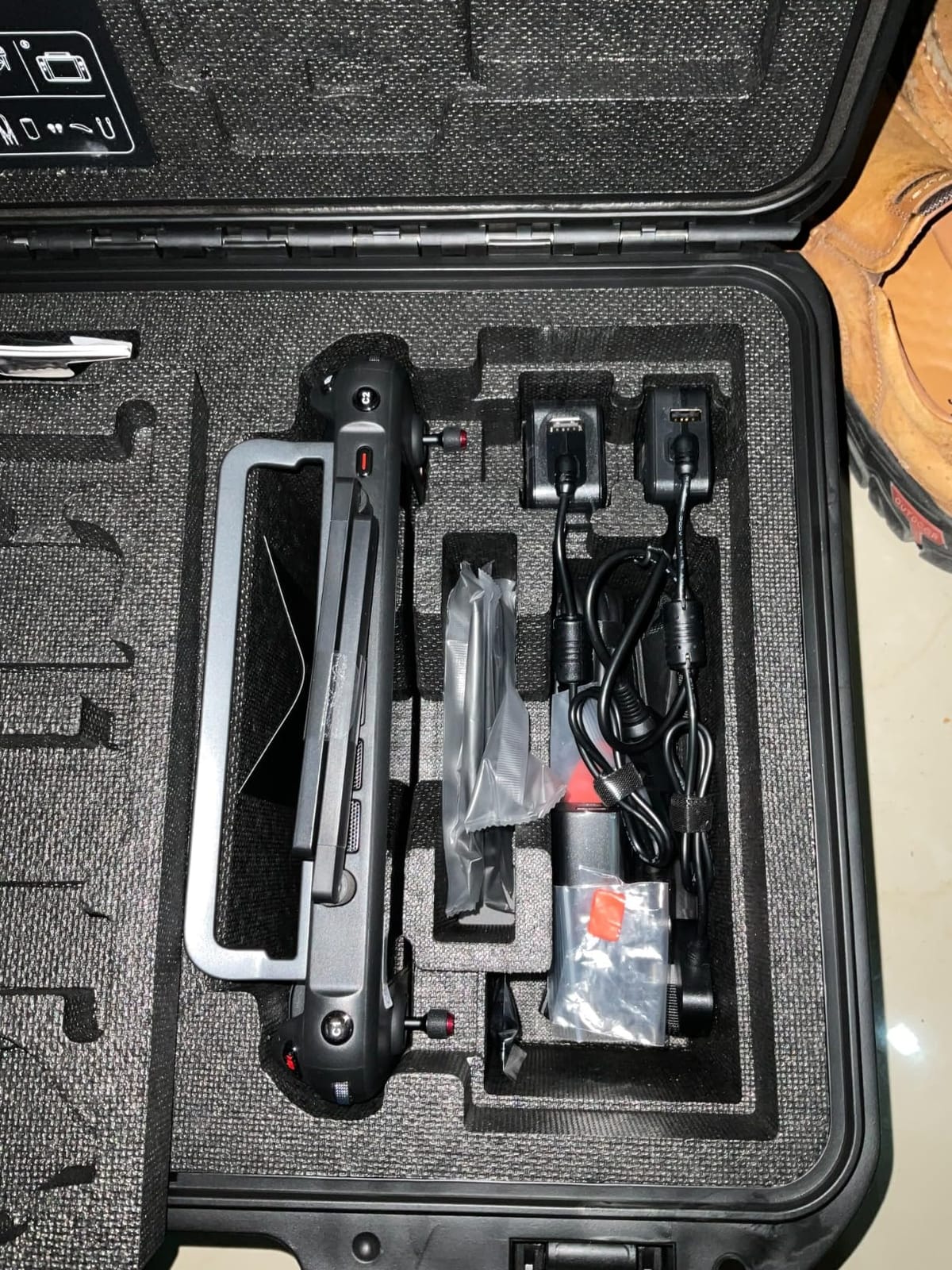
- Three-battery bundle with rugged case and multi-charger
- Bright 2000-nit-class controller readable in direct sun
Cons
- Autel app settings are unintuitive and quick settings are hard to find
- Slim official documentation for advanced RTK and RAW workflows
- Steeper RTK and RAW learning curve than DJI
- One verified report of total mid-flight power loss with unresolved after-sales
The first thing I checked on this aircraft was whether the RTK claim survives a real mapping workflow rather than a spec sheet. Reviewers who fly orthoimagery and 3D reconstruction in Pix4D report the centimetre-level positioning holds, and that is the single most important claim in this entire roundup. Everything else on the platform is good; the positioning is what makes it a survey instrument.
Autel rates it at 1 cm + 1 ppm horizontal and 1.5 cm + 1 ppm vertical accuracy. In plain terms that means roughly centimetre accuracy on a farm-sized block, with a slow drift term that barely matters at agricultural scale. The one number worth internalising is that first one, because it is the difference between a map you can stake a fence line from and a map that only looks precise.
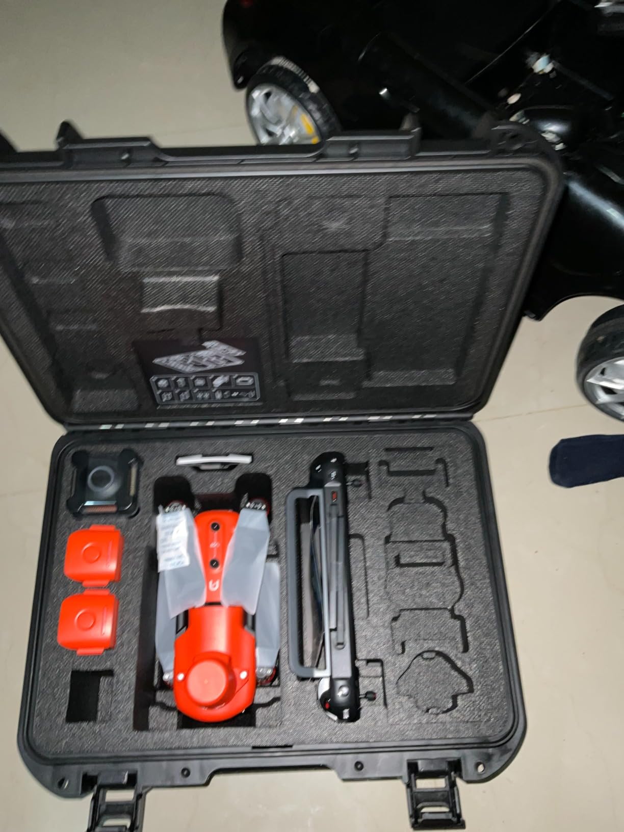
What makes it farm-friendly is the positioning flexibility. It supports RTK base station, NTRIP network correction and PPK post-processing with time synchronization, which means you are not locked into one correction source. If you own a base station, you use it. If your county runs an NTRIP network, you use that. If neither is available on survey day, PPK still works from the logged raw data.
The airframe itself is unremarkable in the best way: 38 minutes of flight time, 15 km video transmission, 360 degree obstacle avoidance, and a 1-inch CMOS shooting 6K at 30 fps with HDR. None of that is headline material. All of it is what you need to fly a 75 to 80 percent overlap grid across a field in one leg and come home with usable photogrammetric data.
What the processed output looks like
Flight at roughly 100 m gives you a ground sample distance in the range most farm mapping work uses, and at that altitude with 80 percent overlap you can process an orthomosaic, a dense point cloud and a DSM straight out of Pix4D or Agisoft Metashape. For an irrigation audit you are usually reading surface height change across a wet area, and this airframe produces that without needing ground control points on the ground beforehand.
The claim that matters most here is that no ground control points are required for survey-grade accuracy. That saves the two-person crew, the half day of walking, and the tape measure work that a GCP-based survey demands. For a farm mapping several hundred acres a month, that saved time is the difference between doing it weekly and doing it once a season.
Where it will disappoint you
The software side is the weak point, and it is worth being blunt about. Autel’s app settings are laid out unintuitively, quick settings are hard to locate, and the official documentation is slim for advanced RTK and RAW workflows. If you are coming from DJI, the learning curve on the RTK functions and RAW processing is steeper than you are used to.
There is also one serious reliability report in the review set: a total mid-flight power loss and airframe loss with unresolved after-sales follow-up. That is a single incident out of nineteen reviews, so it is not a pattern, but for an aircraft priced at this level it is the one review I would want a farm operator to read before buying. Customer service response times are also described as slow by several owners.
2. Autel Robotics EVO II Dual 640T V3 — Best for Thermal Work on Livestock and Irrigation
Autel Robotics EVO II Dual 640T V3, 640×512 Thermal Imaging Drone, RemoteID
640x512 thermal at 30 fps
50 MP RYYB visible camera
38 min flight time
2.5 lb airframe
Pros
- Dual payload gives radiometric thermal and 50 MP visible in one airframe
- Exceptionally stable hover with return-to-landing within two feet
- Picture-in-picture thermal overlay genuinely useful in the field
- Quiet and responsive with strong wind and cold handling
- One reviewer scans roughly 300 acres of pasture on a single battery
Cons
- Non-Enterprise listing does not accept Autel accessory attachments
- Extended coverage is expensive as an add-on
- One verified report of thermal sensor failure inside a year with repair declined
- The case camera-cover vent cracked in service
With 53 reviews behind it, this is the most thoroughly owner-tested aircraft in the roundup, and that also makes it the most balanced. The star score of 4.0 reflects a genuinely capable airframe wrapped in uneven after-sales, which is the honest summary of the whole review set.
The payload is the reason to buy it. You get a 640×512 thermal sensor running at 30 fps on a 13 mm lens with 16x digital zoom and subject recognition out to 100 m, alongside a 50 MP RYYB visible sensor with 4x lossless zoom. One airframe, one flight, both a radiometric crop or thermal assessment and a high-resolution visible map.
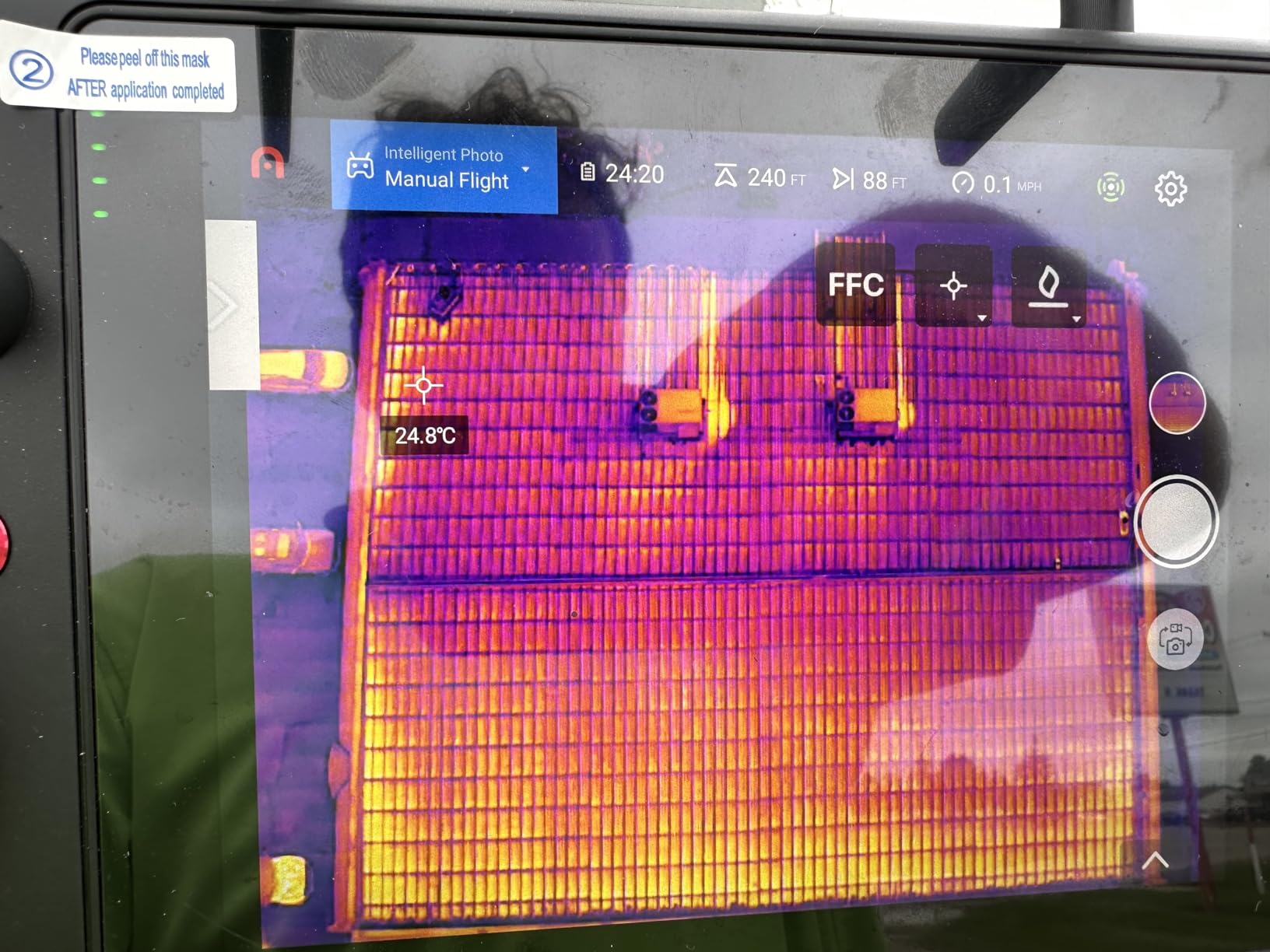
On a farm, that combination answers questions RGB simply cannot. Thermal finds the animal down, the leaking valve, the wet patch in the field that is draining badly, and the hot roof on the equipment shed. The visible 50 MP sensor covers the orthomosaic and boundary work. Reviewers coming from DJI report a smooth transition because the menus and remote layout feel familiar.
Endurance is the other headline. One reviewer scans roughly 300 acres of pasture on a single battery, which lines up with the stated 38 minute flight time. Return-to-landing accuracy has been measured within two feet, and the airframe handles wind and cold better than most operators expect for the class.
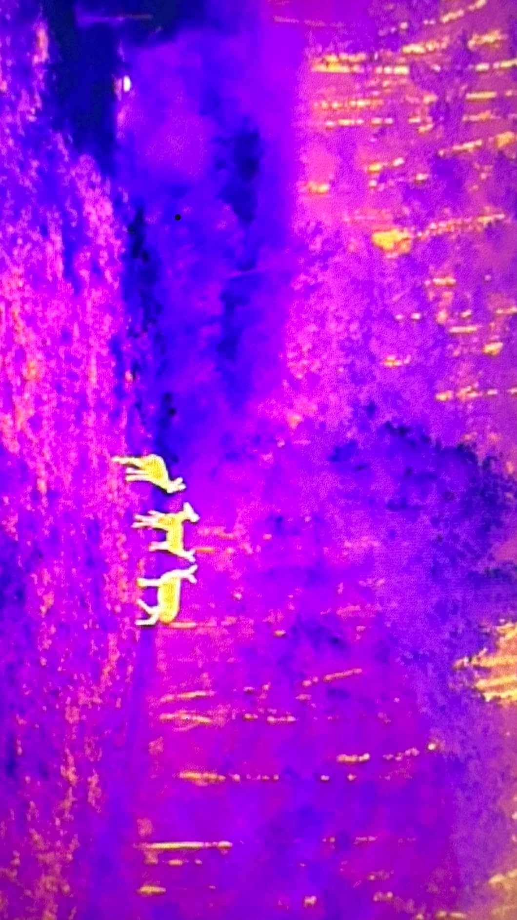
The thermal tooling is properly serious rather than a gimmick. You get detection, recognition and identification ranges, more than ten thermal palettes, central spot and regional temperature measurement, an isotherm mode with a temperature alarm, and picture-in-picture so you can frame a hotspot and inspect it in the visible channel at the same time.
Best use on an actual farm
Pasture and grazing operations get the most out of this aircraft, because livestock inspection is the clearest thermal application. You fly at dusk or overnight, count and locate animals across several hundred acres on one battery, and the visible channel handles the boundary and paddock documentation on the same flight.
Irrigation districts and mixed farms use it for drainage work. A thermal pass over a pivot or a flood-irrigated block after a hard afternoon shows where the water actually sat, which is information a drone with only an RGB sensor will never give you. Livestock counting with thermal at night also beats visible imagery outright, since a visible camera at low light produces almost nothing usable.
Where it will disappoint you
Two things to know before you buy. This is the non-Enterprise configuration, which does not accept Autel accessory attachments. One buyer found that out only after purchase, and if your plan involves mounting additional modules, you need the Enterprise variant instead.
Second, the after-sales record is genuinely mixed. One verified reviewer reports the thermal sensor failing inside a year, with the company citing water damage and declining repair. Another reports the case camera-cover vent cracking in service and needing a paid support plan to cover the fix. Autel’s support responsiveness swings between efficient warranty replacement and slow in both directions.
3. Autel Robotics EVO MAX 4N V2 — Best All-in-One Sensor Payload
Autel Robotics EVO MAX 4N V2, Starlight Night-Vision/Wide/T~hermal/L~aser
Starlight night and 50 MP wide cameras
640x512 thermal plus laser rangefinder
42 min flight time
720-degree obstacle avoidance
Pros
- Night vision and zoom performance singled out as excellent
- Thermal confirmed working as a genuine inspection tool
- Starlight wide thermal and laser consolidated into one airframe
- Proactive repeated manufacturer and seller follow-up on service
Cons
- Only three reviews on record so very little independent field evidence
- Sample size too small to judge reliability or long-term durability
- Single-battery bundle is thinner than the three-battery configurations on the EVO II listings
This is the most capable sensor package in the roundup and the one I would trust least, and both statements are true at once. You get four sensor channels in one airframe: a starlight night camera, a 50 MP wide camera, a thermal camera and a laser rangefinder.
The starlight sensor is the unusual one. At 2.3 MP it is not a mapping camera by any measure, but 0.0001 lux sensitivity and an ISO ceiling of 450,000 mean it sees in conditions where nothing else flies. The wide camera is a proper mapping sensor at 50 MP on a 1/1.28-inch CMOS with an 85 degree field of view.
Then there is the laser rangefinder measuring 5 to 1200 m at plus or minus 1 m accuracy, and thermal with temperature measurement across a minus 4 F to 1022 F range. That combination lets you map by day, inspect by night and measure distance to a target without a second aircraft.
What makes it different in the field
Obstacle avoidance is the standout feature and it is a genuine step up. Millimeter-wave radar combined with binocular vision covers 720 degrees and detects objects down to half an inch, which matters enormously when you are flying a survey grid at low altitude over irregular ground with trees and livestock.
The link is also the most capable here. SkyLink 3.0 runs six antennas across 900 MHz, 2.4 GHz, 5.2 GHz and 5.8 GHz, with AES-256 encryption, an optional 4G fallback and 20 km of range under 150 ms latency. A-Mesh 1.0 lets two aircraft relay for each other beyond visual line of sight, and anti-jamming algorithms counter radio interference and GPS spoofing.
Flight time is 42 minutes, and the V2 hardware revision adds hot-swap battery detection and improved side ventilation. Note that this configuration ships a single battery, so budget for charging time or additional packs.
Where it will disappoint you
There are three reviews. All three are positive. None runs longer than a sentence or two, and none of them describes the mapping and survey workflow that is the reason to consider this aircraft. A 5.0 average across three reviews means no reported problems, not validated by owners.
So judge this one on the spec sheet, not the rating. The sensors are genuinely top-class and the obstacle avoidance is the best in this group. But with no independent field history on photogrammetry performance, you are buying capability on faith, and you should factor in a first-season learning curve on a platform nobody has stress-tested yet at farm scale.
4. DJI Matrice 4TD Quadcopter with RC Plus 2 Enterprise — Best for All-Weather Survey Work
DJI Matrice 4TD Quadcopter with RC Plus 2 Enterprise, Thermal, Wide & Tele Lenses, Laser Range Finder, Low-Noise Anti-Ice Propellers, IP55
Triple-lens array with thermal and NIR
IP55 weatherproofing
Built-in laser range finder
10 lb enterprise airframe
Pros
- Gimbal stability described as extremely smooth with usable long-range zoom
- Thermal zoom holds its zoom state on a target while inspecting
- Holds roughly 35 minutes per battery in 20 mph wind with 30 mph gusts
- IP55 rating and anti-ice propellers suit poor field conditions
- Dock 3 and FlightHub 2 compatibility enables automated survey programs
Cons
- Only two reviews on record for long-term reliability
- DJI Care reportedly unavailable so a third-party plan is needed
- Adding the spotlight accessory can interfere with object detection
- Enterprise dealer route differs from marketplace purchasing
This is the only aircraft in the roundup with a real weather rating, and on a farm that matters more than almost any spec on the list. IP55 covers rain, dust and freezing temperatures, and the low-noise anti-ice propellers are built for cold-weather operation rather than retrofitted.
The payload array is a triple-lens visual setup plus a high-resolution thermal sensor with near-infrared illumination, and a built-in laser range finder for pinpointing a target and measuring distance to it. The NIR illumination is the detail worth noting, since near-infrared capture is the basis of any real vegetation index work from this airframe.
The independent field report in the review set is the most useful single piece of evidence in this whole roundup. One reviewer confirmed readable thermal zoom at long range and roughly 35 minutes per battery in 20 mph wind with 30 mph gusts, landing with two battery lights still showing. That is a real endurance figure in real wind, not a laboratory number.
Where this aircraft earns its place
Early-season work is the scenario. You are trying to fly wet fields in February, or catch a stand before a rain event, and a platform with an IP rating and anti-ice propellers changes whether the flight happens at all. Most aircraft in this roundup are grounded in standing water; this one is not.
Gimbal smoothness matters more than buyers expect. The reviewer described it as video-game smooth and read signage on a water tower ten miles away, which tells you the zoom optics and stabilization are working together properly. The practical application on a farm is asset inspection: irrigation infrastructure, pivot towers, grain bins, fencing lines along a boundary.
If you run a repeatable survey program across a portfolio of fields, the Dock 3 compatibility and FlightHub 2 integration make automated, remote and scalable fleet operation a real option rather than a marketing phrase.
Where it will disappoint you
The evidence base is two reviews, both positive, which is far too little to validate long-term reliability on an enterprise platform. That is the honest limit of what I can tell you from owner feedback.
Two operational warnings are worth repeating. DJI Care is reportedly unavailable in the US, so you need a third-party service plan for coverage. And one reviewer warns that adding the spotlight accessory can interfere with front and side object detection, which on a survey grid is a safety-relevant conflict rather than a minor quirk. Buyers also point to enterprise dealers for better pricing and service plans than marketplace channels offer.
5. Autel Robotics EVO Lite 640T Enterprise — Best Portable Thermal Airframe for Solo Operators
Autel Robotics EVO Lite 640T Enterprise, T~hermal&1/2” CMOS 48MP C-amera
640x512 thermal at 30 fps
48 MP 1/2-inch CMOS visible camera
40 min flight time
866 g foldable airframe
Pros
- Genuine 640x512 thermal payload in a sub-3.5 kg package
- Most portable thermal airframe here for solo carry and deploy
- 48 MP visible sensor covers mapping and documentation
- Enterprise app AI target recognition plots objects on the map
- Three-battery bundle with rugged case
Cons
- Only two reviews with no independent field validation
- 6-inch 800-nit controller is a downgrade in direct sun
- 12 km range and no laser rangefinder limit it against higher tiers
- Smaller 1/2-inch sensor will not match 1-inch sensors for photogrammetric detail
The decision this aircraft helps you make is portability. At 866 g it is the lightest thermal airframe in the roundup by a wide margin, and the EVO Lite 640T Enterprise folds down small enough that one operator carries the whole kit on their back and works a spread-out farm alone without a vehicle running the circuit.
The thermal channel is the same class as the larger EVO II Dual: 640×512 at 30 fps, 9 mm lens, 16x digital zoom. The visible camera is a 48 MP sensor on a 1/2-inch CMOS with a 3-axis gimbal built on a high-precision power-motor structure.
Flight time is 40 minutes, with 17 m/s maximum speed, 12 m/s wind resistance and a 4,000 m service ceiling. The controller is the Smart Controller SE V2 with a 6-inch 1440×720 display at 800 nits, which is the one real compromise in this package.
Best fit for the work
Consultants and agronomists covering many small farms will get the most from this. You are not hauling a case between appointments, you are walking out to a 60 acre field with a backpack. For scattered client work, that weight difference compounds across a week.
The AI target recognition in the Autel Enterprise App is a genuine differentiator rather than a spec-sheet line. It detects people, vehicles and boats and plots them onto the map, which for boundary work and livestock searches saves a lot of manual annotation. It also handles livestock and wildlife counting, and boundary documentation where you need to mark what you found and where.
For crop health work the smaller visible sensor is a limit, so treat this as a thermal-first platform that also documents rather than a full mapping platform. If your priority is the RGB map rather than the thermal channel, the larger sensors elsewhere in this roundup serve you better.
Where it will disappoint you
Two reviews, both 5-star, neither describing the product in any detail. The average reflects an absence of complaints rather than owner validation, and it should carry no weight at all in your ranking decision.
The controller is the honest downgrade. A 6-inch 800-nit 1440×720 screen is materially harder to read in direct sun than the 7.9-inch 2000-nit controller on the higher Autel models, and on a long field day in open country that is not a small annoyance. The 12 km transmission range and the absence of a laser rangefinder also cap it against the enterprise multisensor tier.
6. 2026 Autel Robotics EVO Lite 6K Enterprise Basic Combo — Best Entry Mapping Camera
2026 Autel Robotics EVO Lite 6K Enterprise Basic Combo, 6K 1’’ CMOS
1-inch CMOS with 6K capture
40 min flight time
866 g foldable airframe
Single battery in the Basic Combo
Pros
- Lowest entry cost here while carrying a 1-inch 6K sensor
- Folds to 210 x 123 x 95 mm at 866 g for backpack operation
- Adjustable f/2.8 to f/11 aperture and ISO to 48000
- Offline maps and split-screen useful where cellular coverage is absent
- Three-way front back and bottom obstacle sensing
Cons
- Basic Combo ships with a single battery only
- No thermal payload and no RTK module in this configuration
- Only three-way obstacle sensing with no millimeter-wave radar
- 6-inch Smart Controller SE V2 is smaller and dimmer
- One review with no substantive owner feedback
The 1-inch CMOS sensor is the reason this aircraft is worth a place in a surveying roundup at all. Sensor size drives light gathering, and a 1-inch sensor at 6K produces the kind of raw detail that photogrammetry software can actually reconstruct structure from. Add an adjustable aperture from f/2.8 to f/11 and ISO up to 48,000 in night mode, and you have real exposure control in variable field lighting.
At 866 g it folds to 210 by 123 by 95 mm and stows in a backpack, with 40 minutes of flight time and 12 km of SkyLink 2.0 transmission. Three-way obstacle sensing covers front, back and bottom, which is a step up from the two-way systems on cheaper drones.
The 2026 AI target and environment recognition is worth noting for farm use. Self-learning object detection works across both wide-angle and infrared lenses and can project more than 100 targets onto a digital map in real time, which helps when you are counting or locating scattered features across a large field.
What it is genuinely good for
This is a documentation and mapping platform, and it is very good at that. Orthomosaics, visual crop health assessment, progress documentation, pasture and paddock records, real estate context shots for a farm sale, and general condition monitoring all come out of a 1-inch 6K sensor without difficulty.
Offline maps in the enterprise software matter more in agriculture than in most other sectors, because rural fields frequently have no cellular coverage. Being able to plan and fly a full mission without a data connection removes a whole class of mid-field failure. The split-screen display is useful for checking a captured image against the live map.
If you are comparing this against consumer drones, our guides to the best camera drones and the best drones for aerial photography explain how much image quality you give up for mapping-specific features like autonomous missions.
Where it will disappoint you
Be clear-eyed about two limits. This configuration has no RTK module, so it cannot deliver centimeter-accurate positioning, and it has no thermal payload, so it cannot do livestock or irrigation thermal work. Every survey-grade claim in this roundup depends on RTK, and without it you are flying with GPS accuracy instead of centimeter accuracy.
The Basic Combo also ships with a single battery. A full mapping session means on-site charging or a spare battery bought separately, which is a real workflow cost on a 40-minute aircraft. One review exists on record and it says only that the unit arrived on time as advertised, so there is no owner evidence here at all.
7. Autel Robotics EVO 2 Pro Enterprise V3 — Best for Crews That Need the Accessory Ecosystem
Autel Robotics EVO 2 Pro Enterprise V3 w/Spotlight/Loudspeaker/Strobe
1-inch CMOS with 12-bit DNG raw
42 min flight time
Spotlight loudspeaker and strobe included
Autel Enterprise accessory modules
Pros
- Enterprise configuration accepts Autel accessory modules
- 12-bit DNG raw capture directly useful for photogrammetry
- Spotlight loudspeaker and strobe included in the bundle
- Three-battery bundle with rugged case and multi-charger
- Carbon fiber arms and 42-minute endurance suit repeated survey legs
Cons
- Only two reviews with no performance detail
- No thermal payload in this configuration
- No RTK module despite the shared price point
- 20 MP stills are lower than the 48 MP and 50 MP sensors elsewhere
Two reviews, neither describing flight or imaging performance, so the 5.0 average here is an absence of complaints rather than evidence. The meaningful distinction this aircraft makes is configurational, and understanding it prevents an expensive mistake.
It shares a price point with the EVO II PRO RTK V3, but it is a different trade. You give up the RTK module and gain accessory module compatibility, a spotlight, a loudspeaker, a strobe and Live Deck 2 support. For pure land survey positioning the RTK variant is the correct pick. For crews that need the accessory ecosystem or audible and visual signalling for night operations, this is the more versatile of the two.
Imaging-wise it is solid. A 1-inch CMOS produces 20 MP stills and 6K at 30 fps, and the 12-bit DNG raw capture is directly useful for photogrammetric processing and radiometric work. Moonlight Algorithm 2.0 handles noise reduction for night operations, with 3x lossless and 16x digital zoom, an adjustable f/2.8 to f/11 aperture and ISO to 44,000.
Endurance is 42 minutes on carbon fiber arms, with SkyLink 2.0 transmission to 15 km using tri-band frequency hopping. The controller is the 7.9-inch 2000-nit Smart Controller V3, which is the best screen in this roundup by a wide margin and a genuine upgrade for long days in open sun.
Best fit for the work
Night livestock counts are the clearest fit, because the spotlight and strobe combination makes that operationally realistic rather than theoretical. The loudspeaker serves for wildlife deterrence and for signalling during emergency or search work, and the strobe helps with legal night operations visibility.
For mapping, the 12-bit DNG raw output is the feature to weight most heavily. More than 8 bits per channel means more latitude in post-processing for radiometric work and for pulling detail out of hard lighting, which matters when you are mapping a field at low sun and getting deep shadow.
Reviewers switching from DJI will find the 7.9-inch 2000-nit controller immediately familiar. If you are also mapping fences, gates and infrastructure, our guide to the best drones for beginners covers the control layouts that make that learning curve shorter.
Where it will disappoint you
No thermal payload means livestock and irrigation thermal work is off the table with this aircraft. And no RTK module means no centimeter-level positioning, so it cannot deliver the survey-grade output that the first pick in this roundup delivers. That is the main reason it sits below the RTK variant despite the shared price.
The 20 MP still resolution is also lower than the 48 MP and 50 MP sensors on the EVO Lite and EVO II Dual listings. If your processing workflow depends on the highest resolution RGB data you can get, this is not the airframe. What it does have is a genuinely generous bundle: three batteries, four propeller pairs, multi-charger, car charger, RC spares, a rugged case, 30-day replacement and a 12-month defect service.
How to Choose a Drone for Farm and Land Surveying
The four questions that decide your purchase, in the order you should answer them. Get these right and the model choice mostly follows; get them wrong and no amount of processing software recovers the outcome.
Multirotor or fixed-wing: platform comes first
Every aircraft in this roundup is a multirotor. That is a deliberate limitation worth understanding, because fixed-wing and VTOL fixed-wing platforms cover acreage ranges these cannot.
Multirotor aircraft hover, take off vertically and land vertically, which is why they dominate farm work. They handle uneven terrain, need no runway, can hold position over a point of interest and can fly a tight grid at low altitude for high resolution. Their limit is endurance: 38 to 42 minutes means roughly 15 to 25 minutes of productive mapping per battery, and acreage per day is governed by battery rotation.
Fixed-wing aircraft glide and fly longer, typically an hour or more, so a single flight can cover an order of magnitude more ground. They need a runway or a VTOL launch system, they cannot hover, and they carry less payload. VTOL fixed-wing platforms split the difference by taking off vertically and then flying fixed-wing, which is why they dominate 1,000 acre-plus operations.
My rule of thumb: under roughly 500 acres, a multirotor with a rotating battery set covers a farm day comfortably. Between 500 and 2,000 acres, you are charging batteries between every field and a fixed-wing platform starts paying for itself in labour hours. Above 2,000 acres, fixed-wing is not optional. The agricultural drone category has no fixed-wing listings widely available through consumer channels, which is why this roundup is entirely multirotor, and operators at that acreage scale normally buy a drone service instead.
RTK, PPK or ground control points
This is the accuracy question, and it is simpler than it sounds. RTK corrects the drone position live during the flight using a base station or an NTRIP network. PPK records everything and applies the correction after you land. Ground control points are physical markers you place on the ground, survey with a receiver, and hand to the software as reference points.
RTK is the modern default for a reason. It gives you centimeter-level absolute accuracy without anyone walking a field with a rod. In this roundup the EVO II PRO RTK V3 supports base station, NTRIP and PPK workflows with time synchronization, which means you have three routes to the same accuracy and can pick whichever is available on survey day.
PPK is the backup. If your flight gets interrupted, if you lose correction signal in tree cover, or if you fly an area with no NTRIP coverage, PPK recovers the accuracy from the logged raw data. It is more forgiving in the field, which is why serious operators carry a base station and plan for both.
Ground control points still matter for one case: absolute accuracy on legal boundary work. If a map will be used to argue where a property line runs, RTK alone is usually not sufficient documentation and a licensed surveyor’s control is required. For irrigation, crop health and acreage, RTK without ground control points is the efficient answer.
Sensor choice: RGB, multispectral, thermal or LiDAR
RGB is the workhorse and the right starting point for most farms. It gives you an orthomosaic, a DSM, elevation volumes and volumes, boundary measurement and visual crop health assessment. Six of the seven aircraft here carry RGB as their primary or secondary channel.
Multispectral adds red-edge and near-infrared bands, which is what produces NDVI and NDRE vegetation indices. Those indices are how you find stressed areas before they are visible. No aircraft in this roundup carries a dedicated multispectral payload, which is the one genuine gap you should know about: true NDVI and NDRE work needs a multispectral camera, and the closest capability here is the DJI Matrice 4TD’s near-infrared illumination. If vegetation indices are your primary deliverable, plan a separate sensor purchase.
Thermal measures emitted heat rather than reflected light, which makes it the right sensor for livestock at night, irrigation problems, building insulation, and storm or flood damage assessment. Three aircraft here carry a 640×512 thermal channel, and that is enough resolution for detection and recognition of animals and large thermal anomalies.
LiDAR is different again. It actively measures distance, so it sees through canopy and delivers bare-earth terrain models where photogrammetry sees only canopy height. No LiDAR payload appears in this roundup, and for tree-covered land, dense canopy or bare-earth elevation models you need a platform with a LiDAR mount, typically a VTOL fixed-wing aircraft.
Flight planning numbers that matter
Ground sampling distance is the resolution of your map expressed in centimetres per pixel, and it is set by altitude and sensor size, not by the drone model. Flatter and lower means finer detail and more overlap images, which means more flight time for the same acreage.
Image overlap is the other number. Forward and side overlap of 75 to 80 percent is the standard for photogrammetric reconstruction because the software needs common points visible in multiple images to match them. Drop below 70 percent and gaps appear in the point cloud. Above 85 percent you are buying flight time you do not need.
Wind is the practical constraint that ends mapping days. Wind resistance of 12 m/s on the lighter airframes and stronger figures on the enterprise models tell you the ceiling, but a mapping grid at low altitude in gusty wind is a different problem from a stable hover. Budget batteries by charging time rather than flight time when planning acreage per day, because that is the real constraint on multirotor operations.
The hardware-to-processed-map workflow
The question that comes up most often in farming groups is where to start after the flight, so here is the chain in order. Capture geotagged RGB, multispectral, thermal or LiDAR data on an autonomous grid with 75 to 80 percent overlap, at an altitude matched to your target ground sample distance.
Process that data in photogrammetry software. Pix4D and Agisoft Metashape are the industry standards for survey-grade work, DJI Terra is tightly integrated with DJI platforms, DroneDeploy is the simplest cloud option, and Pix4Dfields is built specifically for crop and pasture work. You get a dense point cloud, an orthomosaic, a digital surface model and a digital terrain model, and the vegetation index layers if you have multispectral data.
Then the analysis software turns those deliverables into decisions. That is the hotspot stage people ask about, and it is where field scouting prescriptions, irrigation zones and variable rate fertilizer maps come from. Hardware choice matters, but it is step one of a five-step chain, and buying a drone without a plan for steps two through five is the most common expensive mistake in this category.
Regulatory basics and data handling
Flying any of these aircraft commercially requires an FAA Remote Pilot Certificate under Part 107 in the US. Remote ID support is built into the aircraft here, which is now required. For spraying work a separate Part 137 certification applies, but none of these seven aircraft spray, so Part 137 does not apply to anything in this roundup.
Insurance matters more than most buyers expect, because a survey flight over someone else’s ground carries liability exposure. NDAA-compliant and US-made platforms are a separate buying consideration that matters for federal, state and defence-adjacent contracts where imagery handling is restricted to domestic manufacture. Check compliance status yourself for your specific contract requirements rather than assuming a brand meets it.
Also be clear on the legal line. A drone map is evidence and measurement, not a survey. Knowing where your fence sits and legally establishing where the boundary runs are different things, with different consequences.
Before going deeper on hardware, our guides to the best mini drones and the best FPV drones cover the two categories that are common first purchases but wrong for surveying work entirely.
When a Drone Is Not Enough: Work That Still Needs a Licensed Surveyor
A drone gives you accurate measurement. A licensed surveyor gives you defensible documentation. Those overlap far less than buyers assume, and knowing where the line sits protects you from expensive mistakes.
Legal property boundaries, easements and rights-of-way need a state-licensed land surveyor. A drone map with RTK accuracy shows you where the fence appears to be; it does not establish the legal boundary, and it cannot resolve a dispute between two neighbours whose fences have drifted apart over decades. If the answer matters to a transaction, a court, or a loan, commission the survey.
Construction staking and design-grade topographic work also need a licensed professional. Engineering-grade deliverable tolerances, datum control and stamped drawings are outside what a photogrammetric processing run produces, even a good one.
Sub-centimetre work in built-up areas with dense vertical structure is another limit, because photogrammetry struggles with occluded surfaces and the reconstruction carries error on building faces and under tree canopy. LiDAR mounted on an aircraft addresses this, but it still does not replace survey control.
There is also an honest economic case for not buying at all. Farms under roughly 150 acres, and operations that need mapping maybe twice a year, usually come out ahead hiring a drone service. The service operator brings the aircraft, the software, the processing expertise and the insurance, and you get a deliverable instead of a learning curve. Plenty of operators in this roundup are not the person flying them.
Frequently Asked Questions
What is the best drone for agricultural mapping?
For most farms the Autel EVO II PRO RTK V3 is the best agricultural mapping drone because it is the only aircraft here with a working RTK receiver: 1 cm + 1 ppm horizontal and 1.5 cm + 1 ppm vertical accuracy, supported by base station, NTRIP network and PPK workflows. It flies 38 minutes with 360-degree obstacle avoidance and carries a 1-inch 6K HDR sensor. For crop health indices specifically, note that no aircraft in this roundup carries a dedicated multispectral payload, so true NDVI and NDRE work requires a separate multispectral sensor.
What is the best drone for survey mapping?
The best drone for survey mapping is the Autel EVO II PRO RTK V3. RTK positioning delivers centimeter-level accuracy without ground control points, and it supports base station, NTRIP network and PPK correction so you are not dependent on one correction source. The 1-inch 6K camera and 360-degree obstacle avoidance handle survey grids well. Accuracy is delivered at 1 cm + 1 ppm horizontal, which is what makes a field edge land where your boundary assumptions expect it.
Which type of drone is best for mapping?
It depends on acreage. Multirotor: best under 500 acres, hovers and takes off vertically, no runway needed, 38 to 42 minutes per battery. Fixed-wing: best above 2,000 acres, an hour-plus endurance, needs a runway, covers far more ground per flight. VTOL fixed-wing: the middle ground from 500 to 2,000 acres, takes off vertically then flies fixed-wing. LiDAR payloads suit bare-earth terrain. For farm mapping under 500 acres a multirotor RTK aircraft is the practical answer.
What is the best drone for agriculture?
For mapping and survey work the answer is the Autel EVO II PRO RTK V3 for survey-grade accuracy, or the Autel EVO II Dual 640T V3 for thermal work on livestock, irrigation and buildings. Note that agriculture drones split into two categories: surveying aircraft that carry cameras and fly measurement patterns, and spraying aircraft that carry liquid tanks and apply product. None of the seven drones reviewed here spray, so spraying needs an entirely different class of machine.
What is the best fixed-wing drone for mapping?
Fixed-wing platforms are the right answer above roughly 2,000 acres, where endurance matters more than hovering. VTOL fixed-wing models are the most practical since they launch vertically without a runway, typically flying an hour or more and covering an order of magnitude more ground than a multirotor per flight. The trade is payload and precision: fixed-wing aircraft cannot hover and carry less, so they suit large-area coverage rather than close inspection. Consumer channels carry few fixed-wing survey listings, so many operators hire a service instead.
What is the best drone for mapping and surveying?
The best drone for mapping and surveying is the Autel EVO II PRO RTK V3, which combines real-time centimeter-level RTK positioning with a 1-inch 6K HDR camera, 38 minutes of flight time and 360-degree obstacle avoidance. It needs no ground control points for survey-grade accuracy and processes into standard orthomosaics, point clouds and surface models in Pix4D or Agisoft Metashape. For most farms under 1,000 acres this is the correct single-aircraft answer.
What is the most affordable RTK drone for mapping?
The most affordable RTK drone for mapping in this roundup is the Autel EVO II PRO RTK V3, the only aircraft here with an RTK receiver. It costs less than half of the enterprise multisensor alternatives while providing the same 1 cm + 1 ppm horizontal accuracy. Two cheaper entries exist, the Autel EVO Lite 6K Enterprise and the Autel EVO Lite 640T Enterprise, but neither includes an RTK module, so they deliver GPS-level positioning only. Check current pricing on the buttons above, as street prices in this category move weekly.
Final Verdict by Farm Size and Survey Task
Pick by acreage and by the job you need done, not by the spec sheet. The best drones for farm and land surveying in 2026 come down to four decisions, and here is the recap.
Under 500 acres mapping row crop or pasture, buy the Autel EVO II PRO RTK V3. It is the only aircraft here with a working RTK receiver at 1 cm + 1 ppm horizontal, it needs no ground control points, and 19 owners have confirmed the accuracy in real Pix4D workflows. That is the strongest combination of validated capability and review depth in the group.
If thermal is your priority rather than positional accuracy, the Autel EVO II Dual 640T V3 is the most thoroughly owner-tested aircraft here at 53 reviews. Radiometric thermal plus a 50 MP visible sensor in one flight covers livestock, irrigation and boundary work together, and one owner scans roughly 300 acres of pasture on a single battery.
Flying in bad weather or running a repeatable survey program means the DJI Matrice 4TD. IP55 sealing, anti-ice propellers and roughly 35 minutes per battery in 20 mph wind with 30 mph gusts is the only field-tested endurance-in-wind figure in this roundup.
For solo operators covering scattered farms, the Autel EVO Lite 640T Enterprise at 866 g is the most portable thermal package. For the lowest entry point with a genuinely capable mapping camera, the Autel EVO Lite 6K Enterprise carries a 1-inch 6K sensor at the lowest entry cost here, accepting that it has no RTK and no thermal channel.
Two honest cautions. First, none of these aircraft carries a dedicated multispectral payload, so if NDVI and NDRE vegetation indices are your primary deliverable you need a separate sensor purchase. Second, several airframes here carry almost no independent owner evidence, and one or two reviews at 5.0 stars means no reported problems rather than validated reliability. Check current pricing through the buttons in each section before you commit, and hire a licensed surveyor for anything that has to hold up legally.